I went thru the AD newsgroups wish site for C3D and found most of my original wishes. Some of these go back to last year and may have already been answered, i didn't;t go thru each one individually but I did see a couple that look like they had been answered in 2007.
Sometime in the future I'm going to take this list and have everyone do some kind of voting to see what they would like to see. I didn't copy over all of the comments that I did receive on the C3D wish site about these, most were very positive and supportive. And some added to them with ther own ideas.
Again if someone would like to add to these just let me know and I'll add them to the list.
Keep in mind I know there maybe some very good work arounds for some of these wishes now, the point is to get C3D to just do it! No work around or the need to buy 3rd party software just to do the following tasks.
Bill N.
Wish #1 – Better quantities
Give us more usable quantities from our assemblies.I.E. l.f. of curb, s.y. of pavement, tons of pavement and from our surfaces let us predetermine where we have existing items, like ex. pavement, ex. concrete ex. sidewalks, curb and gutters and anything else that we may need to add up for quantities. Remove and replace. Give us a way to model this!Some of this could be another property of the sub-assemblies. This is something that shouldn't need the user to create another corridor surface for; this should be as simple as building a report. Think about it when you look at your corridor in 3D, everything is there we just need to be able to add it all up somehow.
Wish #2 – Sheet manager
One idea would be to incorporate this into the MAP - map book creator. Except let follow an alignment instead of a grid.I've been thinking of trying this by stringing out my cross sections left to right in a couple of rows. And then having map book create the layouts.Wish #3 Volumes added to cross sections.
This would satisfy a lot of the country engineers. I’ve heard this comment for years. Just let us add a label that extracts the cut/ and fill from the current section and places the label in a user specified area of the section.
Wish #4 - Automatic Earthwork calcs for a corridor Let us bring in the volume table into the drawing (like LDT does). And make this a simple one button. A byproduct of this haves the corridor creating the DATUM surface AUTOMATICALLY! No more having to go to the properties of the corridor and adding a datum surface and daylight boundary. JUST DO IT……
Wish #5 – Attach a layer state to a Layout .This is more of an AutoCAD wish, but this would enhance C3D, sheet set manager and Pipes. Let us specify a Layer state to a Layout or page setup. I’m sure this would help everyone that uses the Sheet set manager…… So when you plotted on drawing with more than one layout i.e. storm sheets, sanitary sheets etc. You could create different layer states for each layout and have the page setup manage which state to apply during plotting.
Wish #6 An externally located .txt file listing stations. Give us the LDT ability of having a .smp file with the list of the cross section stations that are to be sampled. This would be real handy when you needed to recreate the samples lines, especially if you had a lot of odd stations. You could also add in an addition bit of info like the sample distance Left and right for each section also. Yes, I know you can do this with two additional alignments….But if you tell it to use a text file for the station list how would it know what alignment to sample out too for left and right sides?
Wish #7 - BOM for a specific range of stations..
The ability to create a table of quantities of both existing and proposed items within a given station range and offset area. I.e. from station 5+00 to 10+00 left and right 50ft. Add up everything within the box and list its totals in a table that could be both internally displayed and exported to Excel.Around here both our county projects and DOT projects require on each Plan and Profile to list the quantities of everything that is visible. That is everything that is a bid item removal and proposed. Think about it, at least the proposed items are all right there in front of us in the corridor and pipe networks! The existing items could be the Survey Figures and the existing pipe network (if modeled).One last thing would be to have all these quantities refer to a database to get the current spec and codes used by the DOT.......... I know it can be done! ;) They do it now.....
Wish #8……. New for the day.. The ability to apply a set of feature line styles to corridor.The reason…… Right now in 2006 (not sure about 2007) you can go to the properties of a particular corridor and change the default feature styles for each feature line (i.e. crown, curb line, sidewalk line etc.) basically any of the lines you see in model space and in 3D can be assigned a different style. Meaning we can change the layer, color linetype etc of any of these and also turn them off and on as we please. Which is great?Now the wish. I would like to be able to apply a different set of styles to the corridor feature lines so I can now turn off all off the extra feature lines I don’t need displayed for actual plan creation (i.e. every thing underneath). But I would like to be able to go back and see the complete corridor also.
Wish #9 – Manhole sizing
I get this question at every pipe training session.. Will C3D resize the manhole to accommodate the incoming and out going pipes according to there size and angles between? Nope? But that would be nice.http://www.iowacp.com/catalog/icpc/ICPCmhcb.htmIf C3D could incorporate the above manhole Sizing Calculator.......
Wish #10 – Vault check in..
When you leave a drawing that is tied to Vault have Vault ask you the question, do you want to check in this drawing.
Wish #11 – Pipe/structures editor
Give us a better editor for editing/changing the structure types and design info. And have this include the pipe design info. There was a program out called PipeX that ran with Land Pipeworks that had an excellent editor. The ability to have on one screen one run, IE from manhole #1 to manhole #10 and be able to change design info in one spreadsheet like interface.
I just got off the phone with a client that has been using Pipes and these is his major complaint in that editing pipe data is real slow and tedious. The current rules and automation of the pipe slopes and depths is cool but! In real life the clients are using other design software that tells them the size and slope of the pipes and they must then take this into pipes or pipeworks and draft the design and at that time they will determine the inverts.
Wish #12- Pipe parts report
The ability to run a report on a Network and have a table created with the listing of Pipes with lengths and sizes and Manholes, sizes and heights. Even if this was an external excel file that would be great.
Wish #13 – Tie two different pipe networks together at a common structure, i.e. existing storm to a proposed storm system
Wish #14 – ASHTO Speed tables for vertical FG alignments
Wish #15 – ROW markers in section views, give us the option in the create sample lines.
Wish #16 – Ability to rotate individual points about there node. Like LDT. The only way this can be done now is with a different Label Style with the rotation specified.
Wish #17- Give us a toggle in the corridor properties that tells the corridor to create both a Datum surface and/or Top surface with daylight boundaries. While at the same time let us edit these surfaces if we need to differ the boundaries from the standard daylight lines.
Wish #18 - Mass haul diagrams, as per LDT and to make it even better, add in labeling the actual mass haul numbers. LDT will now at least do the sin wave/mass haul graph.
Wish #19 - Setback and Easement Lines. The ability to show the setback line for each lot and to also show the easement lines (telephone, elect etc) . Be able to specify the actual distance and what sides do and don't have the easements on them, and then have the alike ones fillet at the corners if needed.So you would be able to pick a lot or more than one lot and assign an Easement Set to them and they would just do it! oh and don't forget the ability to label the easement dim.
Wish #20 - Copy all styles. The ability to drag and drop once. The ability to drag a drawing onto an other and have all of the styles updated/added from the first drawing.This would allow a person to create a master styles drawing and work on a different drawing and occasionally as one works on the second drawing, drag it onto the master. Right now this is somewhat possible, but you must remember which styles you've updated/created and where there are in order to do this now. This would help in creating a master depository of styles.
Another way of doing this would be to add into Design Center another tab for styles. This way if the dwg got corrupted we might be able to extract the styles from within. (Maybe,might,possibly,,,,).This would be a way to also extract Styles from the master dwg without opening the master.
Wish #21 – Earthworks report writer. (not from sample lines)
The ability to have some kind of file/report with the earthwork/volume quantities. Volume surfaces and Bounded volumes.We went from one extreme in LDD to nothing at all in C3D. We need to output the numbers and right now it is a bit generic.
Wish #22 – Browse for a style
When you pick an object/label and you want to change the style, how about giving us a option of picking/browsing to a dwg that has the style in it that you want. And have it just list the ones that are in that drawing that correspond to the current object/label you are working with...
Wish #23 – Ability to rotate an individual point by gripping on it and rotating. Just like LDD. This is greatly missed in C3D.Wish #24 – Ability to rotate a parcel label or any label by gripping on it while maintaining the link back to the parcel/object. Currently one must explode the label and then grip and rotate. Just had this requested by a student on Friday, he happens to be the local plat guy.
skip to main |
skip to sidebar
The day before!
New tricks and tips and Future Wishes for Autodesk's Civil 3D......
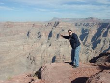
AU2006 and the Grand Canyon
The day before!
About Me
- billneu
- MN, United States
- I'm Bill Neuhauser I'm the Civil Applications Engineer for Alignex inc. out of Bloomington, MN. I have worked for Alignex since the summer of 2005 and prior to that I taught 2 year Civil Techs at Minnesota State Community and Technical College and prior to that I worked for a North Dakota Civil Consultant firm for about ten years as a Engineer, Cadd guy, Cadd manager and supervisor or better know as jack of all trades! I'm also ICE certified for C3D 2006. At one time I figured I had ~25,000 hrs using DCA,Softdesk,LDT and C3D...
2 comments:
Good Site Bill. I like those wishes.
I like your site too Bill. I agree with you that editing pipe runs is tedious and most folks do use other software. I think they do so because pipes is just not giving them enough of what they need. For many though, it is all they have. I've been doing pipeline design since 1983 and I still think piping is just an afterthought to the whole Civil package. Starting in 1992 I began writing my own program to handle sanitary and storm sewers. In 1998 I had about 15 miles of 72" water main to design, including several curve sections, so the program was modified to do both gravity and pressure pipelines (with curves). Since then I've been granting my own wishes (I just love autolisp, don't you?). It does my whole job, design, drafting, sheet sets, and comprehensive takeoffs including trench depths. I don't do much land development work. I mostly do pipelines, cross country or along existing roads. I do use the Land products but mostly for volumes and grading at treatment plant sites or to generate existing grade profiles along a pipeline but even that gets permanently attached to my design so Land Desktop isn't needed until I cut another. What I'm trying to say is that I need very little from Land Desktop and work almost exclusively with my own civil pipeline design app. It is much faster and easier to use. It automatically collects crossing information, sizes, materials, and elevations. It draws and labels them including an ellipse at elevation when the crossing is also a pipe. A preliminary design can typically be completed in an hour or less. A complete set of P&P sheets of unlimited number can be generated in just seconds per sheet (without learning and using sheet manager). I've done over 25 miles, 106 sheets, in less than 5 minutes. A sheet set includes automatic and accurate positioning of plan and profile, right-reading stationing, annotated matchlines, north arrow, bar scale, plan label, stationed sheet title, sheet number, and stations and elevations on profile grid and all without chopping up the plan or profile and its pretty too (IMHO). All of the profile annotation is drawn automatically even including crossing clearance dimensions. The only manual part is annotating the plan and for design nodes only a single pick for location is required. I am very pleased with it and I think anyone doing similar work would be very pleased to use it also. If you want your civil piping wishes granted now, check it out. I have nore info about it on my site paracadd.com
Post a Comment